Project Overview
Measuring walkability across Seoul by pairing eye-level computer vision with the macro pedestrian network, then linking both to housing prices — finding that pedestrian-network connectivity capitalizes negatively (the “Walkability Paradox”).
 End-to-end design from street-view CV and pedestrian network to a SHAP-explained hedonic price model.
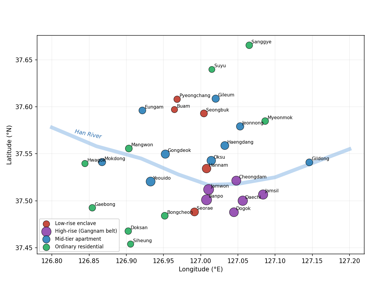 The study sites across Seoul, grouped into four morphological tiers.
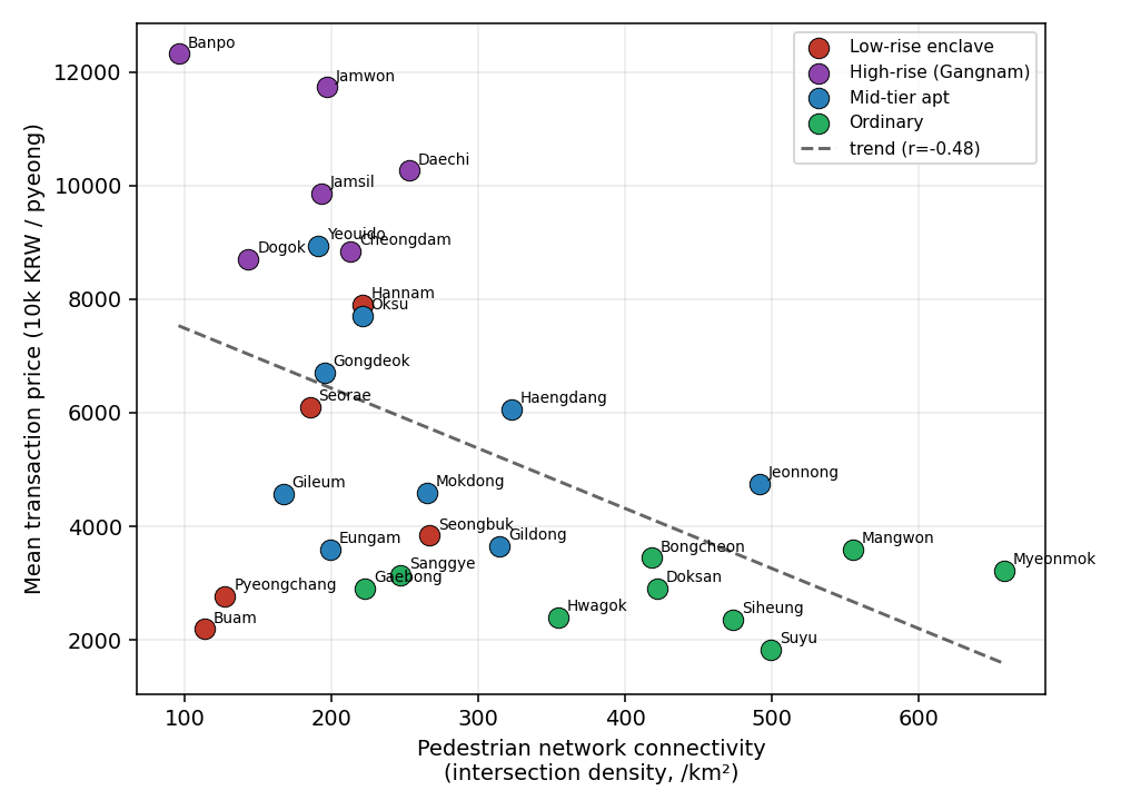 Higher pedestrian-network connectivity is associated with lower housing prices (r ≈ −0.48).
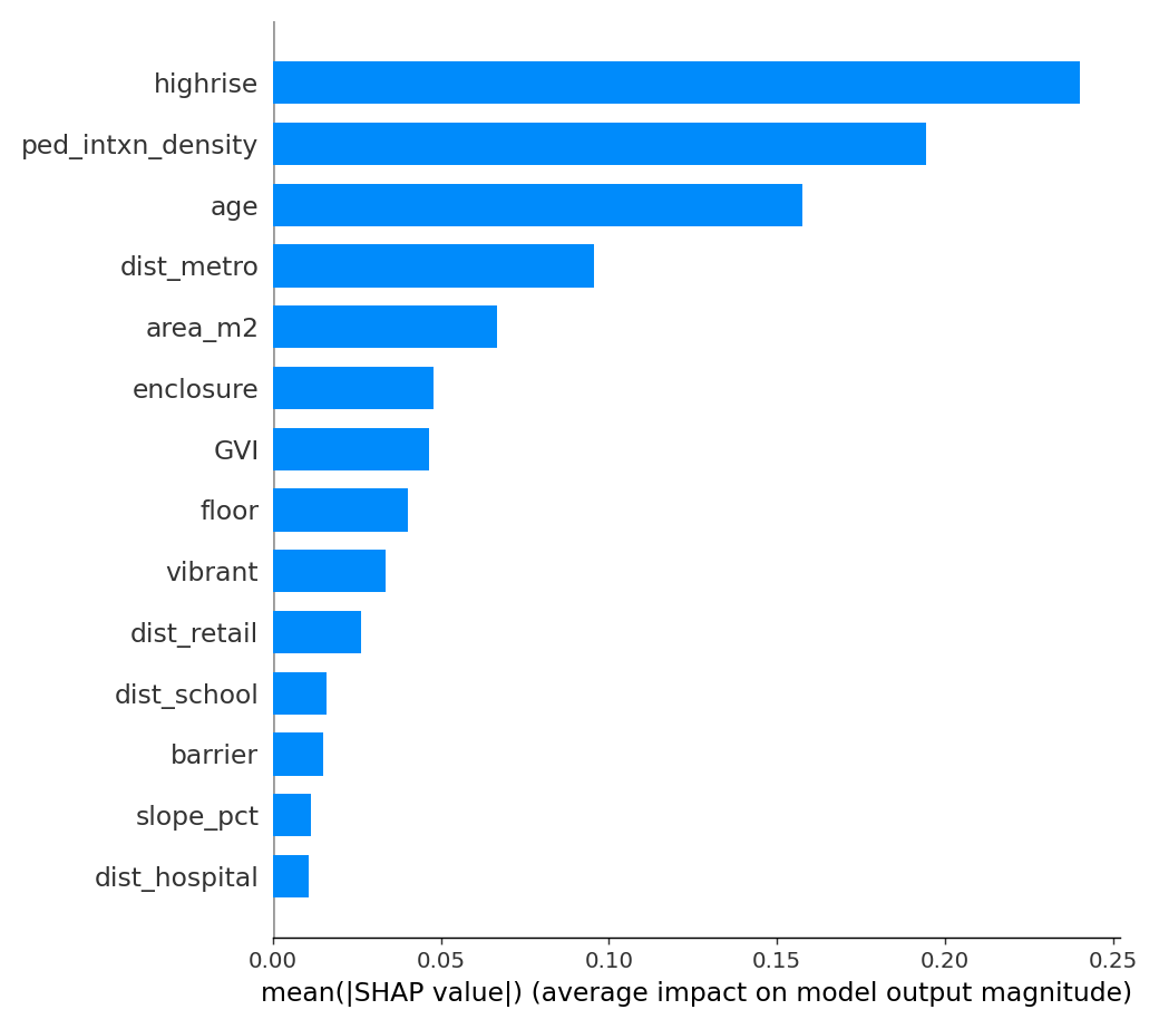 Pedestrian connectivity ranks among the strongest drivers of price in the model.
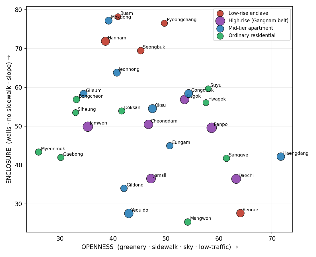 Each neighborhood placed on two CV axes — public openness versus private enclosure.
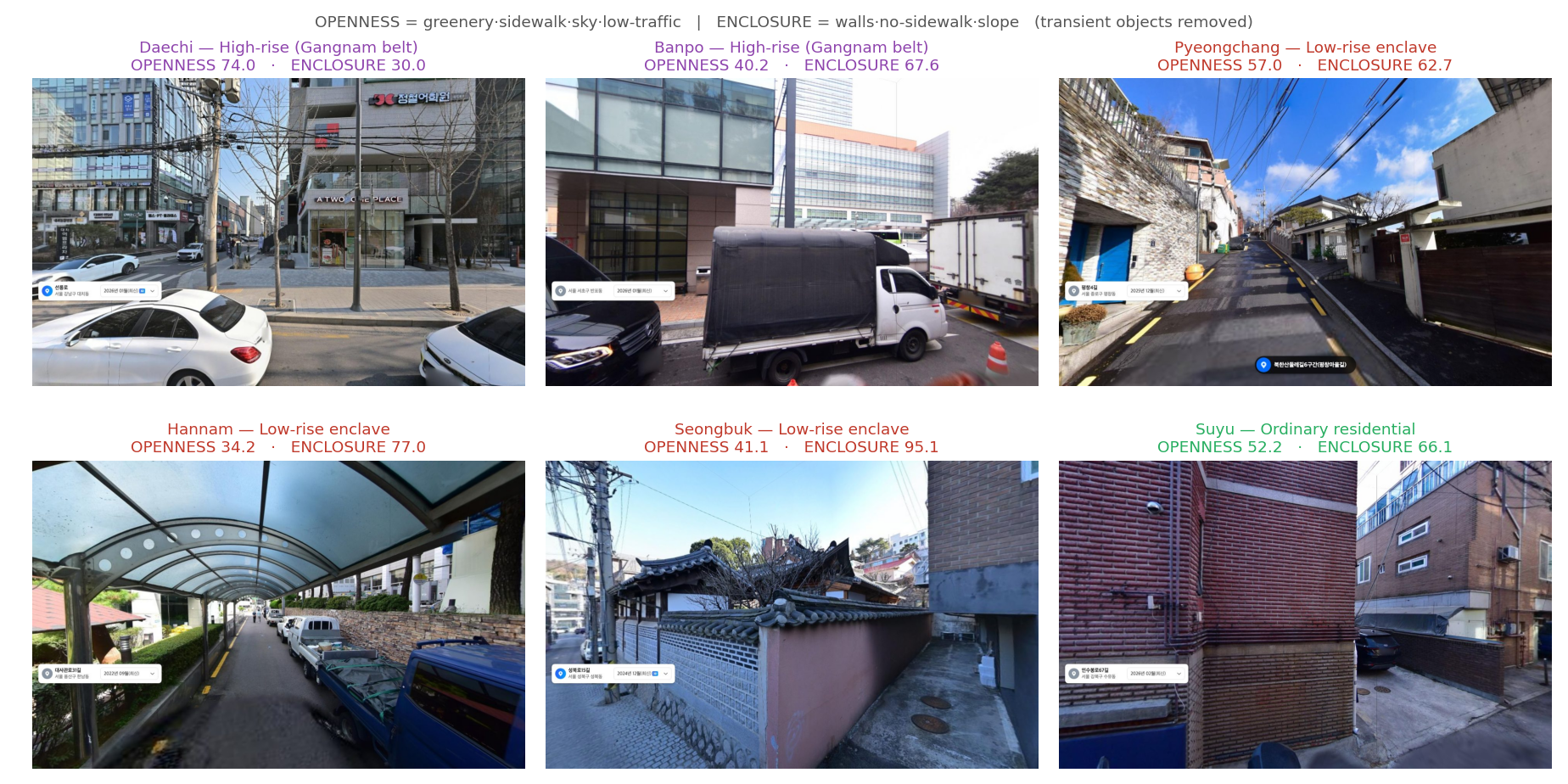 Representative street views illustrating high-openness versus high-enclosure streetscapes.